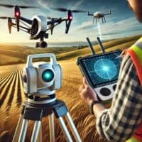
In our previous article, we explored how Drone LiDAR Mapping reduces costs, speeds up surveying, and minimizes labor, but surveying isn’t just about efficiency—it’s about accuracy. While LiDAR-equipped drones are powerful, they’re just one part of the modern surveying toolkit. GPS technology and advanced drone mapping techniques are revolutionizing land surveying, making it more precise, reliable, and versatile than ever. In this article, we’ll explore how drones and GPS enhance accuracy, their benefits, and the future of surveying technology.
The Evolution of Land Surveying Technology
Land surveying has always been about accuracy, but traditional methods had their limitations. Surveyors once relied on instruments like:
- Theodolites and Total Stations – Used for measuring angles and distances manually.
- Measuring Chains and Tapes – Prone to human errors and environmental factors.
- Plane Table Surveying – A slow and time-consuming process for mapping.
While these methods were effective, they required a lot of time and manpower. Thanks to technological advancements, surveyors today can use drones and GPS to collect data with incredible precision.
Modern tools don’t replace the need for expertise, but they enhance the speed and accuracy of surveying, ensuring that projects are completed efficiently and with minimal errors.
What is GPS Land Surveying?
GPS (Global Positioning System) is a satellite-based navigation system that helps surveyors determine precise locations anywhere on Earth. Unlike traditional land surveying, GPS allows for real-time data collection with pinpoint accuracy.
How Does GPS Work in Land Surveying?
Surveyors use specialized GPS receivers that communicate with multiple satellites in space. By calculating the distance between the receiver and satellites, GPS can determine exact coordinates, elevations, and distances.
There are different types of GPS used in land surveying:
- RTK (Real-Time Kinematic) GPS – Provides centimeter-level accuracy and is used for highly precise projects like road construction and boundary surveys.
- Static GPS – Requires data collection over a longer period but is excellent for high-accuracy mapping.
- Differential GPS (DGPS) – Uses reference stations to correct positioning errors, making it ideal for coastal and agricultural surveys.
With GPS, surveyors can map large areas quickly and efficiently, ensuring that land boundaries, elevations, and other measurements are accurate to the smallest detail.
The Role of Drones in Land Surveying
Drones, or Unmanned Aerial Vehicles (UAVs), have transformed land surveying by providing high-resolution aerial images and 3D mapping capabilities.
How Are Drones Used in Land Surveying?
Drones equipped with high-definition cameras, LiDAR sensors, and GPS receivers capture precise data from above the ground. They fly over large areas and collect images and measurements, which are then processed into detailed maps and models.
Types of Drones Used in Surveying
- Fixed-Wing Drones – Best for large-scale surveys like agricultural and infrastructure projects.
- Multi-Rotor Drones – Ideal for smaller, high-precision surveys, such as construction sites and real estate mapping.
How GPS and Drones Improve Accuracy
Combining drones and GPS in land surveying leads to unmatched accuracy and efficiency. Here’s how:
1. High-Precision Positioning
- GPS provides real-time, centimeter-level accuracy, ensuring land boundaries and property lines are measured correctly.
- Drones use LiDAR and photogrammetry to create highly detailed 3D maps, reducing errors in elevation data.
2. Reduced Human Error
- Traditional surveying relies heavily on manual calculations, which can lead to errors.
- Drones and GPS automate data collection, minimizing mistakes caused by fatigue or miscalculations.
3. Faster Data Collection
- A drone can survey hundreds of acres in minutes, while a traditional survey might take days or even weeks.
- GPS receivers work in real-time, so surveyors get instant location data.
4. Improved Safety
- Drones can survey hazardous areas (e.g., steep slopes, construction zones) without putting surveyors at risk.
- GPS eliminates the need for surveyors to navigate rough terrains manually.
Applications of Drones and GPS in Land Surveying
The combination of drones and GPS is used in various industries:
- Disaster Management – Provides real-time mapping after floods, landslides, or earthquakes.
- Construction Site Planning – Ensures precise land grading and foundation placement.
- Boundary and Topographic Surveys – Helps define property lines accurately.
- Infrastructure Development – Assists in mapping roads, bridges, and utilities.
- Agriculture and Forestry – Monitors land usage and soil health.

Challenges and Limitations of GPS and Drone Surveying
While these technologies are revolutionary, they have some challenges:
1. Weather Conditions
- Cloud cover, heavy rain, or strong winds can affect drone flights and GPS signals.
2. Regulatory Restrictions
- Many countries have strict drone regulations, including licensing requirements and flight restrictions.
3. High Initial Costs
- Advanced GPS receivers and surveying drones require significant investment.
- However, in the long run, they reduce labor costs and time.
4. Need for Technical Expertise
- Surveyors need specialized training to operate drones and process GPS data effectively.
Future Trends in Land Surveying Technology
The future of land surveying looks even more promising with new advancements in technology:
- AI and Automation – Machine learning will help in analyzing survey data more efficiently.
- Improved Drone Sensors – Higher-resolution cameras and LiDAR technology will enhance mapping precision.
- Cloud-Based GIS Platforms – Survey data will be stored and processed in the cloud, allowing for real-time collaboration.
These innovations will continue to make surveying faster, smarter, and more accessible.
Final Thoughts
Land surveying has evolved with drones and GPS, making it more accurate, efficient, and reliable. While Drone LiDAR Mapping improves efficiency, GPS and advanced drone technology ensure precision and accuracy in every project.
As technology advances, we’ll see even smarter, faster, and more automated surveying methods.
FAQs
1. How accurate are GPS-based land surveys?
GPS-based surveys provide centimeter-level accuracy, depending on the technology used (RTK GPS can achieve 2-3 cm precision).
2. Can drones replace traditional land surveyors?
No, drones assist surveyors but do not replace their expertise. Human interpretation and validation of data are still necessary.
3. How much does a drone survey cost?
Costs vary based on area size, terrain, and required data. A typical drone survey can range from $500 to $5,000.
4. Do I need a license to use drones for surveying?
Yes, in most countries, commercial drone operators must have a license and follow local regulations.
5. What software is used for drone and GPS mapping?
Popular tools include Pix4D, DroneDeploy, ArcGIS, and AutoCAD Civil 3D.
6. How long does a GPS or drone survey take?
A drone survey can be completed within hours, while a GPS survey might take a day or two, depending on the project size.