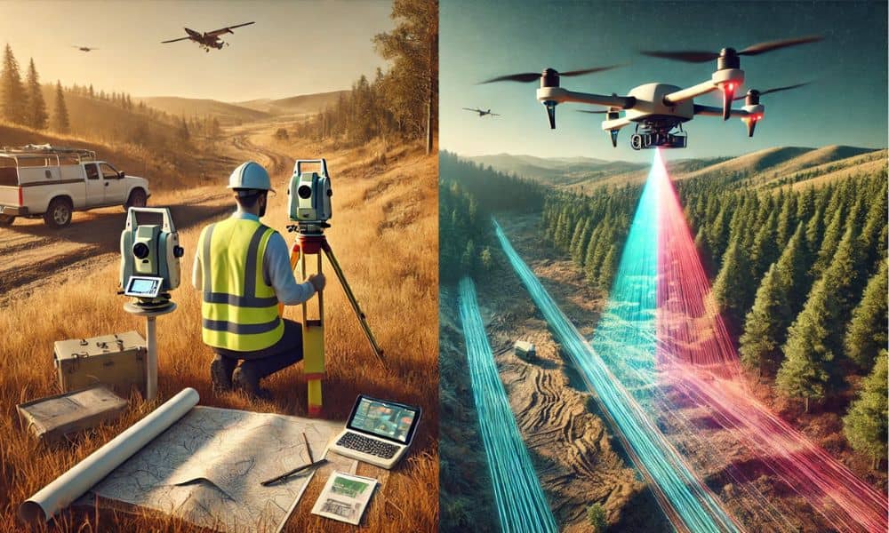
For years, land surveys have been essential for construction, real estate, and infrastructure, but they come with hidden costs—high labor, delays, safety risks, and errors leading to costly rework. Drone LiDAR mapping is changing the game, enabling faster, more accurate, and cost-effective surveying with advanced technology.
But how exactly does drone LiDAR mapping outperform traditional surveys? Let’s break it down.
Traditional Land Surveys: The Hidden Costs
What is a Traditional Land Survey?
Traditional surveys involve measuring and mapping land using tools like:
- Total Stations (Electronic distance measurement)
- GPS and GNSS Devices (Satellite-based positioning)
- Ground-Based LiDAR Scanners
- Manual Measurement Methods
While these methods are widely used in construction, mining, real estate, and agriculture, they are often slow, costly, and labor-intensive.
Hidden Costs of Traditional Surveys
Many businesses fail to consider the true cost of traditional surveys. Here are some of the biggest hidden expenses:
1. High Labor Costs
- Large teams of surveyors, assistants, and equipment operators are required.
- Remote or hazardous locations need extra personnel and safety measures.
- Hiring and training skilled professionals adds to expenses.
2. Time Delays & Project Overruns
- A 50-acre site can take weeks to survey manually.
- Weather conditions and terrain accessibility cause further delays.
- Delayed projects = Higher labor and equipment costs.
3. Safety Risks & Liability Issues
- Surveyors often work in hazardous environments (cliffs, mines, active construction sites).
- Increased risk of accidents and legal liabilities.
- More time spent on safety planning and insurance coverage.
4. Human Errors & Re-Surveying Costs
- Manual errors lead to:
✅ Project redesigns
✅ Boundary disputes
✅ Legal complications - Re-surveys cost thousands in extra labor and equipment fees.
5. Expensive Equipment & Maintenance
- Total stations, GPS devices, and LiDAR scanners cost tens of thousands of dollars.
- Regular calibration and maintenance add to operational costs.
- Transporting equipment to remote sites increases fuel and logistics expenses.
How Drone LiDAR Mapping Saves Money & Time
1. Faster Data Collection & Lower Labor Costs
- Drones can survey large areas in minutes—traditional methods take days or weeks.
- A single drone pilot replaces an entire field survey team.
- Fewer personnel = Lower labor costs.
2. High-Accuracy Mapping with LiDAR Technology
- LiDAR-equipped drones send laser pulses to the ground, capturing highly detailed 3D terrain models with centimeter-level accuracy.
- AI-driven software automates data processing, reducing human errors.
3. Improved Safety & Reduced Liability Risks
- No need for surveyors to work in dangerous locations.
- Drones map mountains, dense forests, construction sites, and disaster zones remotely.
- Fewer accidents = Lower insurance and liability costs.
4. Cost-Effective & Low Maintenance
- No expensive calibration or on-ground setup.
- Drone software automates data collection and analysis—reducing manual work.
- Less equipment to transport and maintain.
LiDAR vs. Photogrammetry: Which Drone Mapping Method Saves More?
| Feature | Drone LiDAR Mapping | Photogrammetry |
| Accuracy | High (cm-level precision) | Moderate (decimeter-level) |
| Penetrates Vegetation? | ✅ Yes | ❌ No |
| Time Efficiency | ✅ Faster (Direct laser measurement) | ❌ Slower (Image processing required) |
| Cost Efficiency | Higher upfront cost, but long-term savings | Lower initial cost but less accurate in dense terrain |
| Best For | Forest mapping, mining, construction, flood modeling | Real estate, general land surveying |
Drone LiDAR mapping saves more money in complex terrains, while photogrammetry is better for open landscapes.
Cost Comparisons: Traditional vs. Drone LiDAR Surveys
1. Construction Industry Case Study
- A 50-acre site takes 2-3 weeks to survey manually.
- A LiDAR drone can complete it in 2 hours.
- Savings: Over 50% in labor and equipment expenses.
2. Agriculture & Land Development Savings
- Traditional surveys cost $5,000–$10,000 per project.
- LiDAR drone surveys cut costs by 30-40% due to faster data collection.
3. Mining & Infrastructure Cost Reductions
- Drones help monitor stockpiles, measure excavation progress, and detect geological risks.
- Cost savings: Up to 60% on labor and operational expenses.
Common Misconceptions About Drone LiDAR Mapping
1. “Drones Are Expensive to Operate”
✅ While LiDAR drones have a higher initial cost, they save money long-term by reducing labor, rework, and delays.
2. “LiDAR Drones Lack Accuracy Compared to Traditional Methods”
✅ LiDAR provides centimeter-level accuracy, often better than manual GPS-based surveys.
3. “Regulations Make Drone Surveys Difficult”
✅ Most countries have clear regulations for drone operations, and obtaining a license is easier than a traditional surveyor’s certification.
How to Transition from Traditional to Drone LiDAR Surveys
1. Choose the Right Drone Technology
- Basic drones for small projects
- LiDAR-equipped drones for high-precision terrain mapping
2. Get Proper Training & Certification
- Obtain a commercial drone license
- Take LiDAR data processing courses
3. Use AI-Driven Software for Better Data Analysis
- Best software for LiDAR surveys: Pix4D, DroneDeploy, ArcGIS
Final Thoughts
Traditional land surveys have hidden costs that businesses often overlook—high labor expenses, slow data collection, and increased safety risks.
Switching to drone LiDAR mapping can:
✅ Cut surveying costs by 30-60%
✅ Improve accuracy with AI-driven 3D models
✅ Reduce project delays and operational risks
FAQs
1. How much can companies save with LiDAR drone surveys?
Up to 60% in labor, equipment, and operational costs.
2. Are LiDAR drone surveys legally accepted?
Yes, most governments approve them for commercial land mapping.
3. What industries benefit the most from LiDAR drone surveys?
Construction, real estate, agriculture, mining, forestry, and disaster management.
4. Do LiDAR drones replace human surveyors?
No, but they enhance efficiency and reduce manual workload.
5. What’s the ROI on switching to LiDAR drone surveys?
Most businesses recover their investment in 6-12 months.