Finishing a construction project does not always mean the work is completely done. Before a new home, building, or addition can move forward, there may be one final step. That step is an as-built survey.
Many property owners focus on permits, inspections, and construction plans. However, they often forget about the survey needed at the end of a project. Missing this step can lead to delays, added costs, and permit problems.
Whether you are building a new home, completing a business property, or adding a new structure, an as-built survey helps make sure everything was built in the right place.
What Is an As-Built Survey?
An as-built survey is a survey completed after construction that shows the exact location, size, and elevation of structures and site improvements after the work is finished.
Unlike other types of land surveying done before construction starts, an as-built survey happens after the project is complete. It records what was actually built instead of what was planned on paper.
A licensed land surveyor measures and records:
- Building size and shape
- Building elevation
- Utilities and drainage systems
- Distance from property lines
- Driveways and parking areas
- Retaining walls and site features
- Any changes from the original plans
The final survey creates a legal record of the completed project.
How Does an As-Built Survey Work?
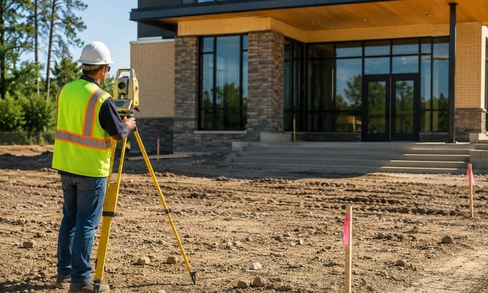
A licensed land surveyor visits the site after construction ends and measures all completed improvements using GPS tools or LiDAR mapping technology.
The process usually follows a few steps:
Review project information
The surveyor reviews building plans, permits, and property documents.
Visit the property
The surveyor measures the completed improvements using GPS tools, total stations, or LiDAR mapping equipment.
Compare measurements
The new measurements are compared with approved plans to see if anything changed.
Create the final survey
The surveyor prepares a certified drawing that shows the finished site conditions.
Submit documents
The survey may be sent to the city, lender, engineer, or title company.
In Minnesota, land surveying work must be completed by a licensed professional.
When Does Your Project Need an As-Built Survey?
Many projects require an as-built survey before getting final approval, utility connections, title insurance, or a certificate of occupancy.
Certificate of Occupancy
Many cities around Minneapolis require an as-built survey before allowing a building to be occupied.
Even a small mistake can create problems. A structure built too close to a property line may cause permit delays.
Construction Loans
Lenders often ask for as built surveys before releasing final construction funds.
This helps confirm the structure was built in the approved location.
Property Closings
Title companies sometimes require an as-built survey for newly built properties.
The survey can find problems like:
- Structures crossing property lines
- Easement conflicts
- Setback issues
- Encroachments
Finding these issues early can prevent legal problems later.
Home Additions and Renovations
Adding a room, garage, or larger building space may also require an as-built survey.
This helps make sure the new structure follows local rules.
Utility Connections
Cities often require survey mapping before approving water, sewer, and drainage connections.
Subdivision Projects
Developers creating roads and new lots may also need an as-built survey before receiving final approval.
What Does an As-Built Survey Include?
A completed survey package from a land survey company often includes:
- Certified survey drawing
- Surveyor stamp and signature
- Building dimensions
- Distances from property lines
- Utility locations
- Drainage information
- Easements
- Elevation information
- Legal property details
These records can also help with future construction projects.
As-Built Survey Cost
As-built survey costs usually range from $1,200 to $4,500 for homes and $3,000 to $10,000 or more for larger commercial projects.
Several things affect pricing:
- Property size
- Number of improvements
- Site conditions
- Slopes or difficult terrain
- Project deadlines
- Equipment used
Some companies using lidar mapping Minneapolis and lidar mapping Minnesota services can work faster on large sites. This may help reduce field time and lower costs.
How to Find a Licensed Land Surveyor
Before hiring a survey company, check these important items:
Verify licensing. Make sure the surveyor has a valid Minnesota license.
Ask about experience. Survey types can vary. Residential work differs from commercial projects.
Discuss turnaround times. Some permits have strict deadlines.
Review technology. GPS and LiDAR tools can improve speed and accuracy.
Look for local knowledge. A surveyor familiar with Minneapolis rules may help avoid delays.
Hiring an experienced surveyor can save time and reduce future problems.
Frequently Asked Questions About As-Built Surveys
What is the difference between an as-built survey and a final survey?
Many people use both terms to mean the same thing. Both describe a survey completed after construction ends.
Do I need an as-built survey for a home addition?
In many cases, yes. Additions often require proof that the structure follows setback rules.
How long does an as-built survey take?
Most home projects take around 3 to 7 business days. Larger projects may take longer.
Can an as-built survey also be used for a FEMA elevation certificate?
Sometimes. If elevation information is collected during the survey, both documents may be completed together.