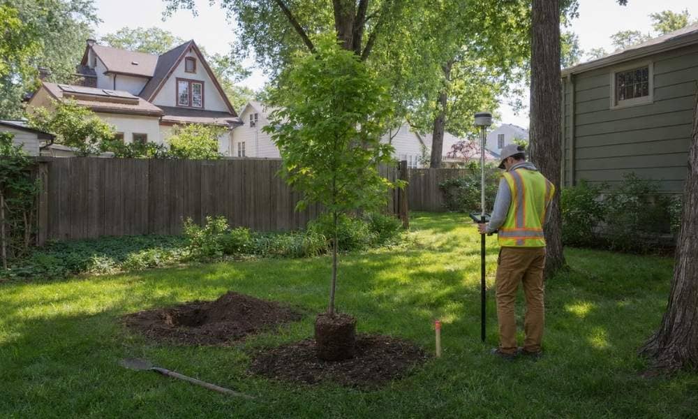
On mature residential streets, a row of old trees, hedges, fences, or landscaping can make it seem obvious where one yard ends and another begins. Before planting a tree that may stay in place for decades, confirm the actual property line instead of relying on appearances.
Why a Mature Yard Can Mislead You About the Boundary
Older residential lots were often landscaped long before current owners moved in. Over the years, fences shifted, hedges spread, and trees were planted wherever they looked good at the time. None of that has to match the legal boundary.
A fence tells you where someone put a fence. A hedge tells you where someone planted a hedge. A sidewalk tells you where the city poured concrete. These features can line up with the property line, or sit a foot or two off it, and there’s often no way to know just by looking.
A yard’s visual edge and its legal edge are two different things. One is what you see when you stand in the yard. The other is a set of coordinates tied to a recorded plat and, in many cases, a monument in the ground. Treating the first as proof of the second is where boundary disputes start.
Start With Minneapolis Property Maps, but Know What They Can and Cannot Tell You
Before you do anything else, check what’s publicly available. The City of Minneapolis offers a property information tool that shows lot dimensions for your address. Hennepin County also maintains a property map with an outline of your parcel.
Both are useful for a first look. Neither one replaces a survey.
Minneapolis describes its property tool as a source for approximate property dimensions, not a precise field location. The parcel outline you see on a screen is built from tax records and public data, not from a field measurement of your specific yard. It can be off by a foot, a few feet, or more, depending on how the original plat was drawn and how the data was digitized over time.
If you’re deciding where to dig a hole for a tree, don’t just eyeball the spot on a map and call it settled. Use the map to get a general sense of your lot, then treat anything close to the edge as still unconfirmed.
What to Check Before You Put a Tree Near the Suspected Line
Once you have a rough idea of where the boundary runs, compare that to your planting plan.
- Look at what’s nearby. Is the spot close to a sidewalk, driveway, street, or utility line? Underground and overhead lines both matter for tree placement, separate from the boundary question.
- Think about the tree at full size, not at purchase size. A sapling from the nursery might be three feet wide. In twenty years, its canopy and root system could reach much further. Root systems commonly spread beyond the tree’s drip line, and roots don’t stop at a property line.
- Know whether you’re planting on private or public land. Minneapolis has separate rules for boulevard trees, meaning the strip of grass between the curb and the sidewalk in front of your home. That’s public property managed by the Minneapolis Park & Recreation Board, and it comes with its own planting process. Planting in your own yard is a different situation than planting on the boulevard.
There’s no single distance rule for every tree in every yard. Species, mature size, city ordinances, and utility easements all factor in. Check what applies to your lot and your tree rather than assuming a standard setback.
When “Find My Property Line” Requires a Licensed Surveyor
Maps, old fences, and rows of existing trees can only tell you so much. At some point, if the planting location is close enough to matter, you need an answer that holds up.
Minnesota’s Board of AELSLAGID , which regulates licensed land surveyors, states that surveyors may establish or re-establish property corners and property lines. That’s a specific legal function. It means locating where the boundary actually sits, based on recorded plats, prior surveys, and field measurement, and marking it in a way that’s recognized if a dispute ever comes up.
Minnesota guidance also covers how property corners are legally monumented by licensed surveyors, meaning a physical marker gets set at the corner so the location isn’t left to memory or guesswork.
If the tree is close enough to the suspected line that a small error would put it on the wrong side, that’s the point where a map or an old fence isn’t enough. A licensed surveyor can confirm the actual location before you dig.
Confirm the Boundary Before a Small Planting Becomes a Long-Term Problem
A tree isn’t a folding chair you can move next weekend. Once it’s established, moving it means digging it up, which can kill it or set it back years. If it turns out to be on a neighbor’s side of the line, that’s no longer a landscaping choice. It’s a boundary problem with a living, growing object in the middle of it.
That’s the real difference between a tree and temporary landscaping. A planter or a row of annuals can be relocated without much thought. A tree that’s been in the ground for ten years, with roots spread wide and a canopy that’s grown into the neighboring yard, is a much bigger issue to untangle.
If your planting plan is anywhere near a shared boundary, resolve the uncertainty first. Minneapolis also has current tree-related guidance and a Tree Preservation Ordinance initiative, so check current City requirements if your planting involves city property or falls under a regulated situation.
Confirm the line. Then decide where to plant.