Imagine buying a home, only to discover that your fence, garage, or even part of your house might sit on someone else’s land. Sounds like a nightmare, right? But believe it or not, this is happening — all because of a boundary survey done over 150 years ago.
Minnesota is currently involved in a massive project to locate and confirm old land survey markers, and it’s stirring up more than just dust. As surveyors uncover original landmarks from the 1800s, they’re finding that modern property lines don’t always match up. This may not seem like a big deal at first, but for homeowners, builders, and buyers, it can lead to real problems.
The Hidden Markers Beneath Our Feet
Back in the 1800s, land surveyors laid out most of Minnesota using wooden stakes, rocks, or metal pins to mark section corners and property lines. These markers were part of the Public Land Survey System (PLSS), a method used to divide and sell land across the U.S.
Fast forward to today: many of those original survey points are buried, broken, or lost altogether. Without them, counties and cities had to estimate boundaries using older maps and less accurate tools. That’s where the problem starts.
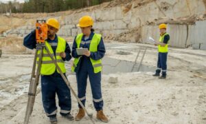
Now, teams of modern surveyors are digging up these original markers — literally — to correct the public record. In counties like Becker and Polk, they’ve found that only about 9% of corner markers had accurate GPS coordinates. The rest? Well, they were either missing or off by several feet.
Why It Matters
You might wonder: “That’s up north. What does it have to do with me in the city?”
Many property lines — especially in older neighborhoods — were built on assumptions. Over time, maps, fences, and even buildings were placed based on outdated or estimated lines. But now that surveyors are verifying the original markers, those assumptions are being challenged.
When a new boundary survey is done using these re-established points, it can show that a property line is not where everyone thought it was. That can mean:
- Your neighbor’s garage is on your lot.
- Your fence crosses over city land.
- A builder needs to move an entire structure just to meet code.
These aren’t rare situations anymore. They’re popping up all over as remonumentation efforts (that’s the term for re-marking old survey points) continue across the state.
What Is a Boundary Survey, Anyway?
Let’s keep this simple. A boundary survey is a legal way to measure and map out exactly where one piece of land ends and another begins. It uses both modern GPS tools and historical data (like those old markers) to create a precise, up-to-date layout.
Think of it as a property’s blueprint — one that’s accepted in court, by lenders, and by local governments.
Here’s why that matters:
- A county’s online map (called GIS) isn’t always accurate.
- Your property deed may describe the lot, but not show it clearly.
- Only a licensed land surveyor can legally confirm where your land begins and ends.
In short, a boundary survey gives you the truth — not just an estimate.
Real Problems, Real People

One Minneapolis homeowner recently found out that a treehouse they built for their kids was technically on their neighbor’s land. Why? A new boundary survey done before a home sale revealed that the fence line was wrong — by nearly two feet. This kind of mix-up is surprisingly common when property lines in Minneapolis are based on outdated maps or assumptions rather than verified surveys.
Another case involved a local developer who had to delay a project because the land parcel they purchased turned out to be slightly smaller than expected. It was enough to throw off their building plans, which meant redesigns, permit delays, and extra costs.
Both of these issues could have been avoided if a proper survey had been done earlier — using the corrected, historic monument data.
The Role of Licensed Surveyors
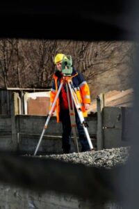
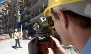
This is not a DIY job. Only a licensed land surveyor can conduct a legal boundary survey. These pros are trained to find (or re-establish) the true corner points of your property — even if that means digging through gravel roads or checking old handwritten records.
They combine GPS, drone technology, and historical documents to get it right. And they’re often the first to catch mistakes that could cost thousands later.
In fact, surveyors are now working closely with counties and cities to help update official maps and prevent future disputes.
What You Can Do Right Now
If you’re a homeowner, builder, or real estate investor, here are some smart moves to make:
- Get a boundary survey before you build, buy, or subdivide.
- Don’t trust your fence, a neighbor’s word, or even county GIS maps.
- Ask for a current survey as part of your due diligence when buying property.
- If you’re selling, consider including a boundary survey in your disclosures — it builds trust and can speed up the process.
This becomes even more important in older parts of the city, where land has changed hands many times and records may be outdated or inconsistent.
Old Data, New Impact
Who knew a 150-year-old boundary survey could cause so much modern chaos? But that’s exactly what’s happening — and it’s not slowing down.
The good news? You can stay ahead of the confusion. All it takes is understanding what a boundary survey is and knowing when to get one.
So whether you’re putting up a fence, building a home, or closing on a new property, don’t skip this step. A small investment in a professional survey today could save you from big headaches tomorrow.


