Water does not care about property lines. It runs downhill, no matter who owns the land. That simple fact is why drainage reviews exist. And it’s why survey mapping is the first real step in passing one.
In Minneapolis, most building projects need sign-off from a watershed district before construction can start. These districts check how a project handles rainwater. If the numbers do not match the real ground, the review stalls. Survey mapping is what gives builders the real numbers before that happens.
Here is how it works, and why it matters more than most site plans admit.
Contour Mapping Before the Watershed District Does: How Survey Data Predicts a Review’s Outcome
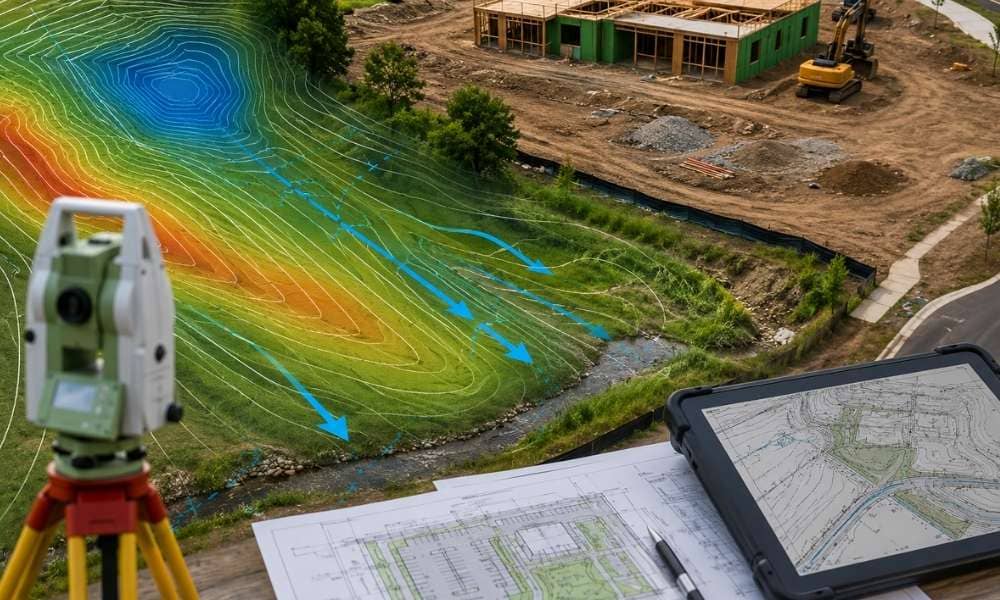
A contour map shows the shape of the land. High points. Low points. The slope between them. This data comes from a survey, not a guess.
Builders who order this early can see problems before a reviewer does. Maybe water pools near a proposed building pad. Maybe a slope drains straight toward a neighbor’s yard. Either issue can sink a drainage review.
Catching these problems before submission saves real time. A rejected plan means weeks of delay. A plan built on real contour data has a much better shot at moving through review on the first try.
The Impervious Surface Count That Decides Your Stormwater Fee
Impervious surface means anything that stops rain from soaking into the ground. Roofs. Driveways. Patios. Parking lots.
This number does two things. First, it decides how big a stormwater detention system needs to be. Second, it often decides how much a property owner pays in stormwater utility fees. Many Minneapolis-area fee structures charge based on how much of a lot is covered this way.
A survey measures this number for real. Guessing it, or pulling it from an old site plan, is risky. Get the number wrong, and either the detention system is undersized, or the fee bill is wrong. Both problems show up later, and both cost money to fix.
Why a Site’s Watershed District Rarely Matches Its Property Line
Minneapolis sits across several watershed districts. Bassett Creek. Shingle Creek. Minnehaha Creek. The Mississippi Watershed Management Organization. Each one sets its own drainage rules.
Here is the part many builders miss. A single lot can sit inside more than one of these districts at once. The property line and the watershed boundary rarely line up.
A survey is what actually shows this split. Without one, a builder might design around just one district’s rules. Later, they find out part of the lot answers to a different set of standards.
Flow Path Mapping: Showing Where Water Actually Goes Before Engineers Design Around It
Flow path mapping is different from a flood zone map or an elevation certificate. It shows the direction water moves across a site during rain.
Engineers need this before they can size anything. A swale. A rain garden. A detention pond. All of these depend on knowing where water naturally wants to go.
Guessing this direction from a site plan is common, and it is a mistake. Ground shifts. Old drainage patterns change once new grading happens nearby. A current survey shows the real flow path, not the assumed one.
Grading Plan Conflicts: What Survey Elevations Catch That Site Plans Miss
An architect draws a grading plan based on the information they have. Sometimes that information is a rough estimate, not a real measurement.
Survey elevations catch the gap. Maybe the plan assumes a flat lot, and the real lot has a two-foot drop across it. Maybe a low corner was never accounted for at all.
These mismatches are a top reason a drainage review bounces back with corrections. Each round of corrections costs a builder time. And time on a construction schedule is money.
Getting Ahead of the Review
The pattern here is simple. Every drainage review checks real ground conditions against a submitted plan. Survey mapping is what makes those two things match from the start.
Order the survey early, before the site plan gets finalized. Fixing a drainage conflict on paper is cheap. Fixing it after a rejected review, or after construction starts, is not.