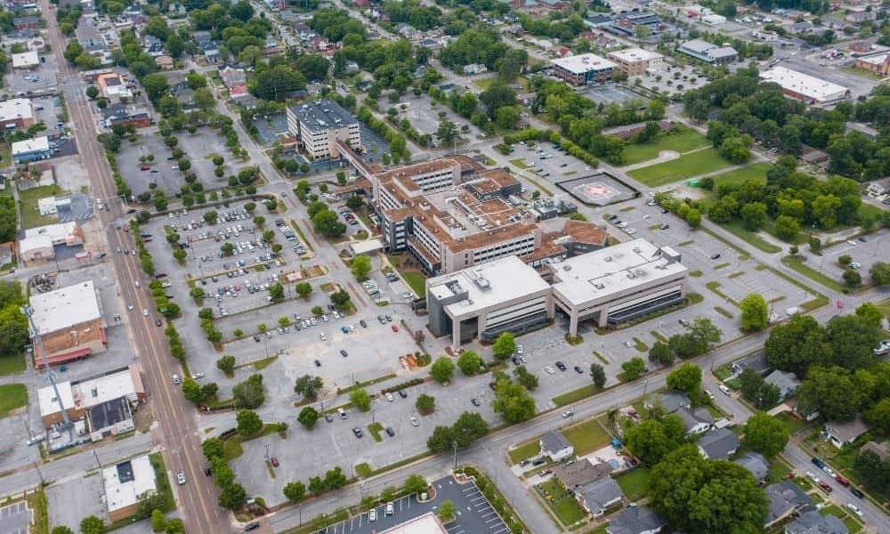
If you own or plan to build on a busy city block, the alley behind your building matters. So does the way cars and people move around your property. Survey mapping puts all of this on one clear map. It shows where the alley sits next to your property line. It shows how cars and people move through the site. It also shows where parking can go once you factor in setbacks, drive lanes, and turning room.
This matters most on blocks where space is tight. If your lot backs up to a shared alley, sits close to a sidewalk, or shares access with another property, a basic boundary survey is not enough. You need a map that shows the full access picture, not just your property lines.
Survey Mapping the Access Network on Dense Urban Blocks
Survey mapping on a busy city block means recording every spot where people and vehicles come and go. This includes the alley, the street in front, any shared driveways, and paths like sidewalks or crosswalks.
Many neighborhoods still use an old grid layout with alleys running behind homes and buildings. On these blocks, a survey needs to show how the alley connects to the street. It should also show how nearby properties use that same alley. A map that only shows your property line can miss a problem. That problem might only show up once trucks, work equipment, or emergency vehicles try to get through.
The goal is a full and clear picture of access. That means widths, clear space, sight lines at corners, and the current condition of pavement and curbs.
Capture Alley Connections Before Reworking the Site
Before you change parking, move a building, or add landscaping, you need to know how the alley connects to your site. This step confirms the alley’s width. It also shows how it lines up with your property line. It checks for anything sitting inside the alley space, like a fence, shed, or roof overhang.
Alleys in older parts of the city were often laid out decades ago. What is shown on old records does not always match what is really there today. A garage built too close to the alley, a wall that creeps over the line, or a drainage ditch that was never recorded can all show up once a surveyor checks current measurements against the old plat.
This step also shows if the city maintains the alley or if nearby owners share it privately. That answer affects who can use it, who takes care of it, and what changes are even possible without talking to neighbors or the city first.
Map Parking Geometry Beyond the Stall Count
A parking count only tells you how many spaces you have. It does not tell you if those spaces actually work. Survey mapping looks at the full shape of the parking area. That means drive lane widths, turning space, stall sizes, and the path a car takes from the street or alley into a spot and back out again.
On a tight city lot, being off by just a few feet can cause real problems. Cars may not be able to back out safely. Delivery trucks may not be able to turn. Accessible spaces may not meet the size they need. Mapping the real conditions first, instead of guessing that standard sizes will fit, gives you a solid starting point for any changes.
This step often turns up surprises too. A curb cut that does not line up with painted spaces, a utility pole sitting in what should be a drive lane, or a slope that affects how a car sits. These details only show up once a surveyor measures the site as it truly is today, not as it was first designed on paper.
Build a Circulation-Ready Existing Conditions Base
Once the alley connections and parking layout are recorded, the next step is putting everything onto one map. This map becomes the base for any circulation planning. That could mean redoing a parking layout, adding a loading zone, or improving how people walk through the site.
A strong base map usually includes property lines, easements, the alley and where it connects, existing pavement and curb lines, utility locations that affect paving or striping, and any slopes that affect drainage or accessibility. With all of this on one map, an architect, engineer, or contractor can design around real conditions instead of guessing.
This step matters most on infill and redevelopment projects. Busy city blocks rarely give you a clean slate. A circulation plan built without accurate site data often runs into problems once construction begins.
Match Survey Mapping Scope to the Project Decision
Not every project needs the same level of detail. A property owner repaving an existing lot may only need mapping of the parking area and alley connection. A developer planning new construction with new access points usually needs a wider survey. That survey should cover the full site, nearby rights-of-way, and any easements that affect circulation.
The right scope depends on the decision you need to make. If you are applying for a permit to change a curb cut or alley access, the city may ask for specific proof of both current and planned conditions. If you are checking out a property before buying it, you may just need to confirm that current parking and access setups are legally documented, not informal.
Talk with a surveyor about your project goals before work starts. This helps make sure the mapping matches what you truly need. It also helps you avoid paying for more detail than the project calls for, or missing something a permit review will catch later.