If you are about to build, fence, or remodel near a property line, here is the short version. A licensed land surveyor pulls old plats first because today’s fence or stake might not sit where the law says it should. Skip that step and you risk a survey that gets challenged later, costing you time and money. The takeaway: old records protect new projects.
Why Historic Neighborhood Plats Still Influence Property Corner Locations
Minneapolis grew fast in the late 1800s and early 1900s. Developers carved farmland into blocks and lots, then recorded those layouts as plats at the county. Those original drawings still control how your lot is legally defined.
How Minneapolis’ older subdivisions were originally documented
Surveyors back then used chains, compasses, and later, transits. They set wooden stakes or iron pins at corners and recorded bearings and distances by hand. Many of those plats are still on file at Hennepin County.
Why plats recorded decades ago remain valuable references
A plat from 1910 is not outdated. It is the legal birth certificate of your lot. Courts and counties still treat it as the controlling document unless it was formally replaced.
Differences between original subdivision plats, later revisions, and recorded dedications
Some neighborhoods saw revised plats, lot splits, or street dedications added over the decades. Each layer can shift how a lot reads on paper. A surveyor has to know which version applies to your parcel right now.
Why modern improvements do not replace historical legal records
A new driveway, fence, or retaining wall does not erase old boundary lines. Improvements built without checking plats often sit a few feet off, and that gap shows up the moment someone sells, refinances, or builds next door.
What a Licensed Land Surveyor Looks for When Reviewing Old Plats
Before any field crew touches a tape measure, a licensed land surveyor studies the paper trail. This step shapes every measurement that follows.
Comparing recorded dimensions, bearings, lot layouts, and monument notes
Old plats list lot widths, angles, and sometimes notes about original monuments. A surveyor lines these numbers up against what exists today to spot gaps early.
Identifying inconsistencies between historical records and current site conditions
Streets get widened. Alleys get vacated. Lot lines on paper sometimes stop matching fences, walls, or pavement on the ground. Catching that mismatch before marking corners saves a redo later.
Reviewing adjoining parcels to understand the original subdivision layout
One lot rarely tells the whole story. A surveyor checks neighboring parcels too, since a single block usually shares the same plat history and the same set of clues.
Using multiple historical sources instead of relying on a single document
No surveyor leans on one old plat alone. County records, prior survey files, and deed history all get cross checked. More sources mean fewer surprises.
Why Existing Property Corners Are Not Always the Original Ones
A stake in the ground looks official. It is not always correct.
Missing, disturbed, or replaced monuments over time
Original iron pins get pulled by frost, lawn equipment, or old construction crews. Someone may have set a new stake decades later, in the wrong spot, with good intentions and no survey behind it.
Effects of utility work, landscaping, street reconstruction, and redevelopment
Trenching for gas lines, sewer repairs, and sidewalk replacement all disturb soil near corners. A monument that survived one century of weather can vanish during a single utility project.
Why apparent corner markers require professional verification
Anyone can hammer a stake into dirt. Only a licensed surveyor can confirm whether that stake matches the legal description and the plat it came from.
How historical evidence helps distinguish original corners from later replacements
Old field notes, prior survey maps, and recorded ties to nearby monuments help a surveyor tell the difference between a true original corner and a guess someone made years ago.
Combining Historic Records with Modern Survey Technology
Old plats set the legal framework. Modern tools confirm it on the ground.
Using GNSS, robotic total stations, and digital mapping alongside archived plats
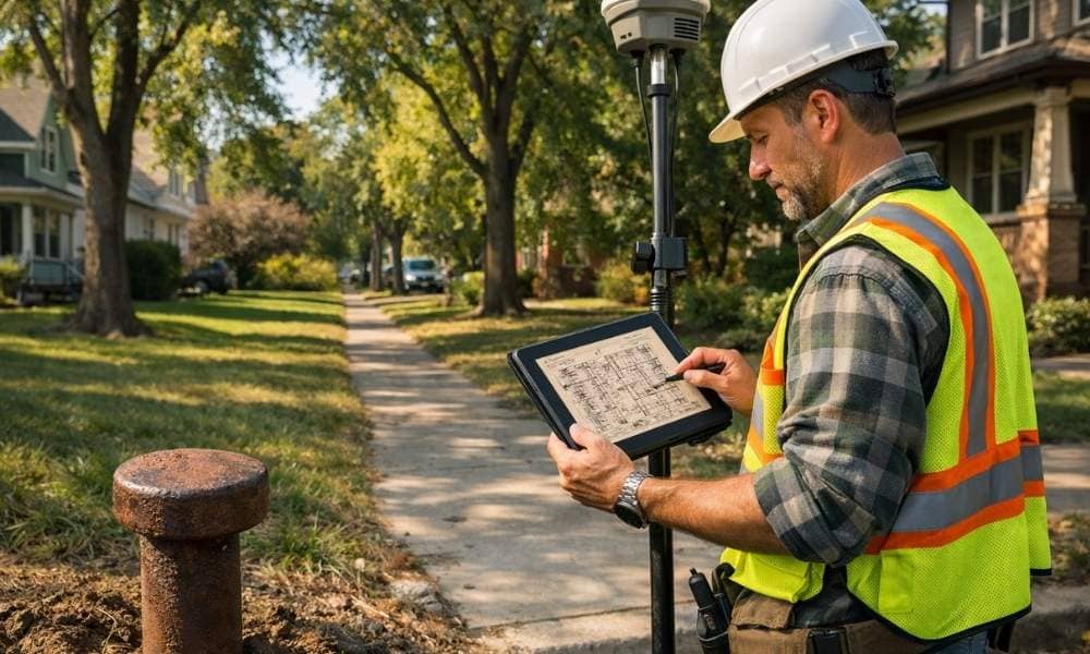
GNSS receivers and robotic total stations capture precise coordinates fast. But raw coordinates mean little without the historical record to interpret them against.
Field verification instead of relying solely on GPS coordinates
A GPS point can sit a few inches or feet off the true corner if the underlying control or interpretation is wrong. Physical verification in the field, tied back to the plat, closes that gap.
Reconciling historical measurements with present-day conditions
Distances measured with a chain in 1915 will not match a laser measurement exactly. A surveyor accounts for that drift using accepted methods, not guesswork.
Producing defensible corner locations supported by both records and field evidence
The goal is a corner that holds up in a title dispute, a building permit review, or a future sale. That only happens when paper records and field measurements agree.
Why Early Plat Research Helps Projects Move More Smoothly
This step happens before design, not after.
Reducing unexpected questions during design and permitting
Cities ask for setbacks measured from real boundaries. Plat research up front means your architect designs against accurate lines, not assumptions.
Helping architects, engineers, and contractors work from verified boundaries
Everyone downstream, from the engineer sizing a foundation to the contractor framing a wall, depends on the surveyor getting the corners right first.
Avoiding delays caused by conflicting historical records discovered late
Finding a plat conflict mid-construction is expensive. Finding it during planning is just paperwork.
Supporting long-term property documentation for future improvements
A clean, well-researched survey becomes the reference for every future project on that lot, from additions to subdivisions.
Frequently Asked Questions
1. Why does a licensed land surveyor review old plats before marking property corners?
Old plats are the legal source for where a lot’s boundaries actually sit. Skipping that research risks marking corners in the wrong place.
2. Are historic neighborhood plats still legally relevant today?
Yes. Unless formally replaced, an original recorded plat still controls the legal description of the lots within it.
3. Can modern GPS replace historical plat research?
No. GPS gives precise coordinates, but those coordinates only mean something when checked against the historical legal record.
4. What happens if an old plat conflicts with current site conditions?
A surveyor investigates the conflict using additional records and field evidence, then documents a defensible conclusion about where the true corner sits.
5. Is historical plat research only necessary in older neighborhoods?
No. Newer subdivisions have their own recorded plats too. Any property can have a gap between paper and ground.